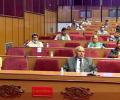
A house meeting has been scheduled for Saturday as per the Parliament's notice and the matter relating to the constitution amendment bill is likely to come during the meeting, parliamentary sources said. Meanwhile, in a conciliatory tone, India on Thursday said it deeply values its friendly ties with Nepal.

Now, the bill will undergo a similar process in the National Assembly, wherein the ruling Nepal Communist Party commands two-thirds majority.
India has already termed as untenable the 'artificial enlargement' of the territorial claims by Nepal after its Parliament unanimously approved the new political map of the country featuring Lipulekh, Kalapani and Limpiyadhura areas which India maintains belongs to it.
Nepal last month released the revised political and administrative map of the country laying claim over the strategically key areas, more than six months after India published a new map in November 2019.
The meeting came days after Nepal Prime Minister K P Sharma Oli telephoned his Indian counterpart Narendra Modi to greet him on India's 74th Independence Day, in the first high-level contact after bilateral ties came under severe strain following issuance of a new political map by Nepal in May.

Though General Naravane's visit will not deal with 'impermanent' issues like the changing stands of politicians, it will certainly reinforce the deeper 'permanent' links between the people of Nepal and India. Time will hopefully tackle the present impermanence of the Sino-Nepalese romance, notes Claude Arpi.

Gen Naravane's visit to Nepal from November 4-6 is largely aimed at resetting bilateral ties that came under severe strain following a bitter border row between the two countries.

Naming Pakistan, Singh said it keeps trying to destabilise India through terrorist activities and a stern message has already been given to it.
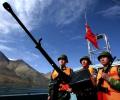
Both the Indian and Chinese armies have brought in more troops in sensitive locations like Demchok, Daulat Beg Oldie and areas around Galwan river as well as Pangong Tso lake in Ladakh, the sources said. The area around Galwan has been a point of friction between the two sides for over six decades.

The India-Nepal bilateral ties came under strain after Defence Minister Rajnath Singh inaugurated a 80-km-long strategically crucial road connecting the Lipulekh pass with Dharchula in Uttarakhand on May 8.

'Although the real Ayodhya lies at Thori in the west of Birgunj, India has claimed the Indian site as the birthplace of Lord Ram'

But it does not mean we will let our self-esteem be hurt, Rajnath said in the message to the armed forces on the eve of Independence Day.
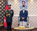
PM Oli said that "there has been good friendship between Nepal and India".

According to India's assessment, the release of the new political map by Nepal and obtaining a legal backing to it from the lower house of Nepalese Parliament were part of a "myopic" agenda to gain mileage in domestic politics.
The ties between India and Nepal came under strain after defence minister Rajnath Singh inaugurated a 80-km-long strategically crucial road connecting the Lipulekh pass with Dharchula in Uttarakhand on May 8.

The turning point in his career was undoubtedly Nepal where he was sent as ambassador and acted with a cool head.

Pilgrims travelling through the Lipulekh Pass in Uttarakhand will continue as scheduled.
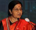
The yatra will continue for the next four months.
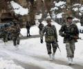
'The Indian Army's surveillance had noticed the Chinese movements.' 'There was no intelligence failure.'
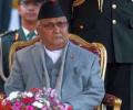
'The Prime Minister's remarks that India was conspiring to remove him was neither politically correct, nor diplomatically appropriate,'

'The missile mounted near Kailash-Mansarovar is called DF-21. It is a medium-range, 2,200 kilometres ballistic missile. Its advantage is that it can cover all cities of north India, including New Delhi'

Recalling the 1962 War, Napalchayal said when Chinese troops reached near the Darma, Vyas and Johar valleys in the district, villagers helped the Army carry ammunition and food to border posts on sheep and mules.
'The redrawing of the map with the inclusion of Kalapani area by Nepal and endorsement from the House of Representatives shows the KP Oli government's move to gain cheap popularity in the name of nationalism'

Shringla began his two-day official visit to Nepal on Thursday. He was accorded a warm welcome on his maiden visit to Nepal which is happening at the invitation of Nepal Foreign Secretary Paudyal, amid a strain in bilateral ties following a bitter border row between the two countries.
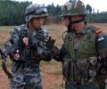
It is learnt that the India's top military brass is constantly monitoring the evolving situation even as the United States said the aggressive behaviour by Chinese troops was a reminder of the threat posed by China.
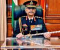
Nepal raised objection to India's newly-inaugurated road linking Lipulekh Pass with Dharchula in Uttarakhand.

In 2017, a retired R&AW officer conveyed that Uttar Pradesh Chief Minister Yogi Adityanath was keen to get monarchy restored in Nepal and suggested that I support these efforts.

Udit Wahie took the arduous trek and felt blessed.

China on Monday opened the second land crossing in Tibet via Nathu La to allow the first batch of Indian pilgrims undertaking the arduous Kailash-Manasarovar Yatra, in the latest confidence-building measure between the two neighbours.

The time is ripe to extend the confrontation with the Chinese to the maritime domain, says former RA&W officer Krishan Varma.

Marking a historic occasion, Nathu La, the famous Himalayan pass at 14,500 feet on the Sino-India border in Sikkim reopened after 44 years this morning for trade between the two neighbours.

The operational alert allows troops to get acclimatised to high altitudes, renovate the bunkers and trenches from which they would fight, break out ammunition, and carry out the coordination needed to fight an integrated defensive battle.

A weaker Russia, a sobered China at a time when Xi Jinping is manoeuvring to protect his third term prospects, a reunited West, a chaotic Pakistan. This is a perfect set of strategic circumstances. It is for India now to consummate this historic opportunity, argues Shekhar Gupta.
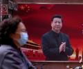
China has not limited the 'battle' to the diplomatic field alone; the People's Liberation Army has become aggressive on the ground too. The recent 'fights' in Northern Sikkim and Ladakh are part of the pattern, asserts Claude Arpi.
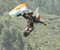
So far, the Central Sector has never seen active hostilities, remaining peaceful even through the 1962 war. A reason for the Central Sector having remained peaceful is the towering Himalayan watershed that defines the border.
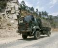
Some organisational changes are likely in some of the key army formations.
